Revolutionizing Utility Operations: the Intersection of Interactive Mapping and GIS
The world is only advancing, and the integration of cutting-edge technology with traditional processes is crucial for improving efficiency and accuracy in our industry. OpSource exemplifies this intersection, leveraging interactive mapping and Geographic Information Systems (GIS) to transform utility operations. This article explores how OpSource’s innovative approach to digital mapping enhances utility engineering, offering real-time […]
Streamlining Utility Contracting: The Role of Utility Contractors

Utility contracting is a vital process that involves the design, installation, maintenance, and management of essential utility systems such as water, gas, electricity, and telecommunications. OpSource enhances utility contracting by providing advanced tools and solutions that streamline project management, improve data access, and facilitate collaboration. Utility contractors play a crucial role in ensuring that these […]
Leveraging GIS Mapping: Exploring the Benefits of GIS
In today’s digital age, Geographic Information Systems (GIS) mapping has become an indispensable tool across various industries. From urban planning to environmental management, the utilization of GIS technology has revolutionized how organizations analyze and visualize spatial data. Let’s dive into the nitty gritty and explore the advantages of mobile GIS platforms and GIS in the […]
The Future of GIS: Innovations in GIS Technology
The field of geographic information systems (GIS) is rapidly changing through emergent technologies. The rise of artificial intelligence (AI) and other technological advancements in geospatial technology is revolutionizing the field. Geographic information science and geospatial data is useful in almost every field. Developments in GIS mapping have improved spatial analysis, data visualization, and more. Creating […]
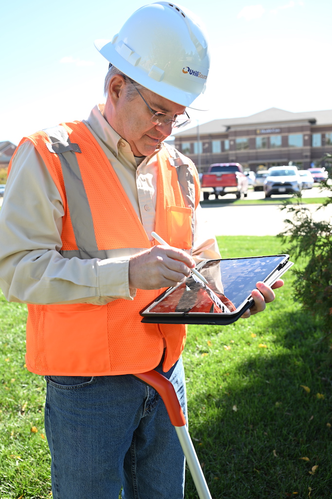
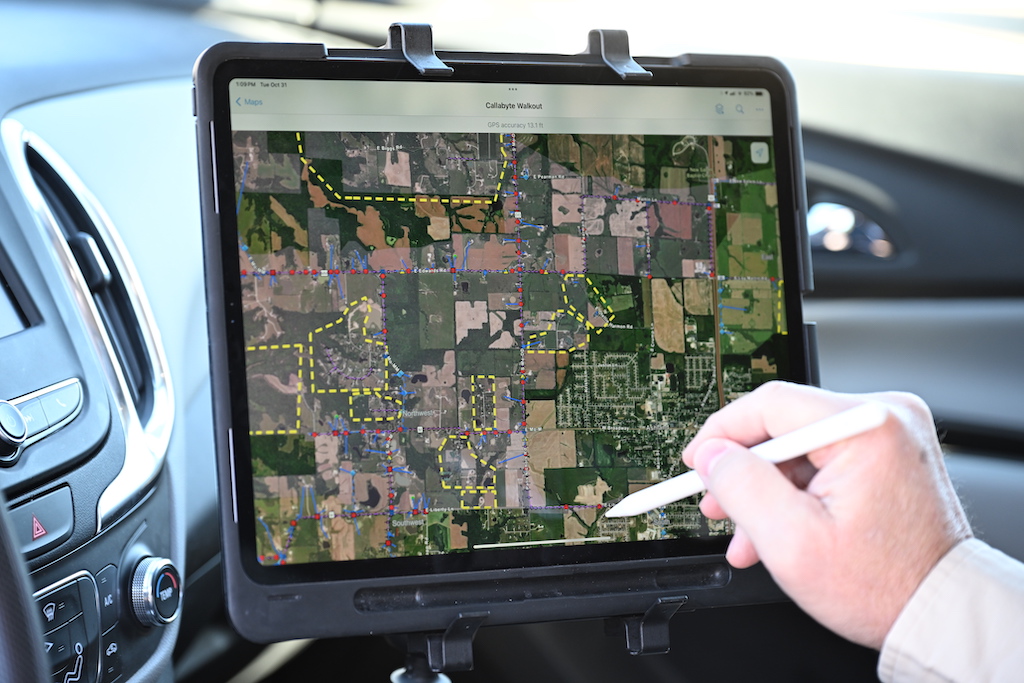
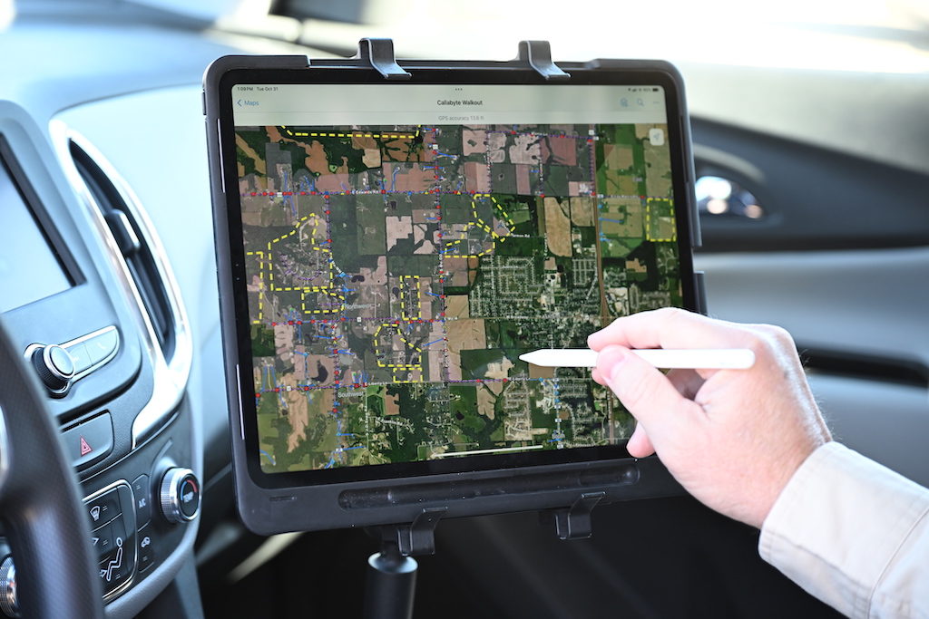
GIS Data Collection Techniques to Increase Efficiency and Save Time

Across industries, field operations rely heavily on GIS to collect, manage, and analyze spatial data. Geographic Information Systems (GIS) must be utilized effectively in order to manage data capture and ensure that all data is accurate. With the amount of data needed, field operators and technicians need to be able to collect survey data quickly […]
Finding GIS Technology and Innovations in the Real World

Did you know that GIS, or geographic information systems, are at work in our daily lives, in ways that touch almost every aspect of our lives? Technological advancements in the field impact our lives and the world immensely. City management, agriculture, utilities, and more, GIS mapping is critical to our infrastructure and works in the […]
The Role of GIS for Utilities: A Guide
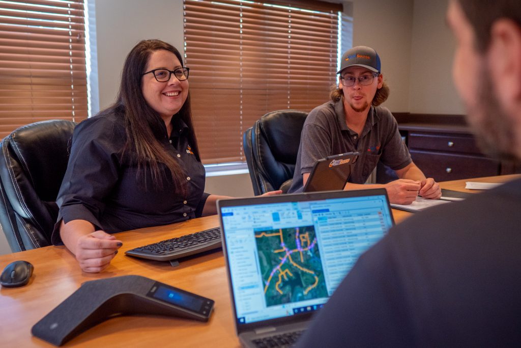
GIS is critical for mapping and creating data. For industries that create large amounts of data, like the utility industry, using GIS for utilities has significant benefits. What is GIS? Geographic Information Systems (GIS) is a type of data collection that creates, manages, analyzes, and maps data. GIS technology connects your data to a map. […]